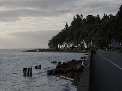
Maple Beach
At low tide, one can practically walk across Boundary Bay on the sand flats, but at high tide the water comes right up to the seawall. The upper beach and the berm of this sand spit is long gone beneath the roadway, although in recent years, nourishment has been used to rebuild the beach and provide protection to the wall itself.
Maple Beach: August 2006
The beach derives much of its coarse sediment from the bluffs at Lily Point south of here. And this beach is just the base of a much larger system of historic and modern spits that extends north across the border to Centennial Beach and Beach Grove in Tsawwassen.
The "C" on the marker might stand for Canada, although I suspect it does not. The border is a bit of a groin and the seawalls are just as impressive north of the border as south.


0 Response to "Maple Beach"
Posting Komentar