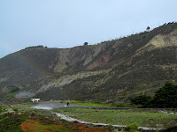
Daly City is where the San Andreas fault heads out to sea. It arrives from the south by way of a series of fault valleys and elongated lakes and reaches the coast just north of Mussel Rock. It continues northward offshore past the entrance of the Golden Gate before reconnecting briefly with California at Point Reyes.
There's a large divot where the fault intersects the high bluffs, at least in part due to past landslides. In the 1960's tidy rows of homes were built along the top edge of the bluffs. Remarkably, most of them are still there.
AERIAL VIEW
Mussel Rock Park is the site of a historic landfill, now closed, but heavily fortified with riprap. Mussel Rock itself is a large block of Franciscan rocks squeezed out along the fault, and described in the opening passage of McPhee's Assembling California. As McPhee notes, this is a good (but often foggy) spot to "sit and watch the plates move." Which I suppose is the attraction of those homes perched at the edge of the precipice, witness to storm waves, landslides, and plate tectonics.


0 Response to "Mussel Rock"
Posting Komentar