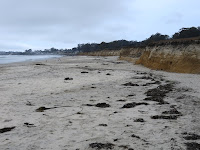
 Half Moon Bay has been the site of considerable coastal geologic investigation and story telling, but the short version is that construction of the harbor and breakwater in 1959 changed the wave environment throughout the bay, mucked up the equilibrium (to the extent there is ever an equilibrium with beaches) that governed the shape of the coastline, and led to some serious erosion in areas south of the breakwater. Which continues more than 50 years later.
 View Larger Map
The erosion has cut into the low, but easily erodible bluffs, some of which have buildings on top of them, so now there are some impressive riprap revetments lining the shore.
Half Moon Bay is a nice example of a log spiral beach, formed in the lee of the Pillar Point headland. I think legitimate questions have been raised about how accurate that mathematical description is - you can probably fit a log spiral to almost any curve if you want.
For you surfer dudes, Pillar Point is the site of Mavericks. I've included a neat NOAA image of the bathymetry below -- that's some cool structural geology creating the surf break!


0 Response to "Half Moon Bay"
Posting Komentar